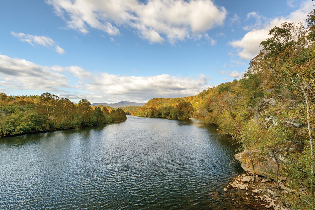
Roanoke River
The Roanoke River loosely follows the border between North Carolina and Virginia. This 410-mile river makes its way from the city of Roanoke in the Blue Ridge Mountains, across the Piedmont, into the coastal plain, where it eventually joins the Albemarle Sound.
The river has a rich history and an abundance of wildlife. Animals and fish that make this river their home include striped bass, catfish, heron, ducks, osprey and bald eagles. It’s not unusual to see raccoons, opossum, river otters, nutria, muskrats, beavers and even black bears on the riverbanks.
The floodplain around Roanoke River is the largest intact hardwood forest in the Mid-Atlantic. The scenery in the “Blueway,” the area called upcountry near the city of Roanoke, is where people go tubing and wading. The landscape changes as the river moves east to the lowlands, forming pristine bald cypress swampland and water tupelo forests.
The Roanoke River is also a popular waterway for recreational boaters and fishermen. People seeking gentle whitewater experiences should try the Class I rapids around Roanoke Rapids. The Roanoke River Paddle Trail has put the lower Roanoke River on the recreational map. With over-water camping on 26 river platforms, this trail attracts more than 1,400 paddlers annually for overnight stays (with 5,000 additional day paddlers). These river platforms are designed to blend into the natural environment and each is unique—some consist of a walkway leading to a flat wooden structure for camping. Others, like Tusca Landing and Tillery, offer screened porches. For places to stay, in addition to the culturally-rich city of Roanoke, consider Halifax and Roanoke Rapids. Drive time is three hours from Fairfax.
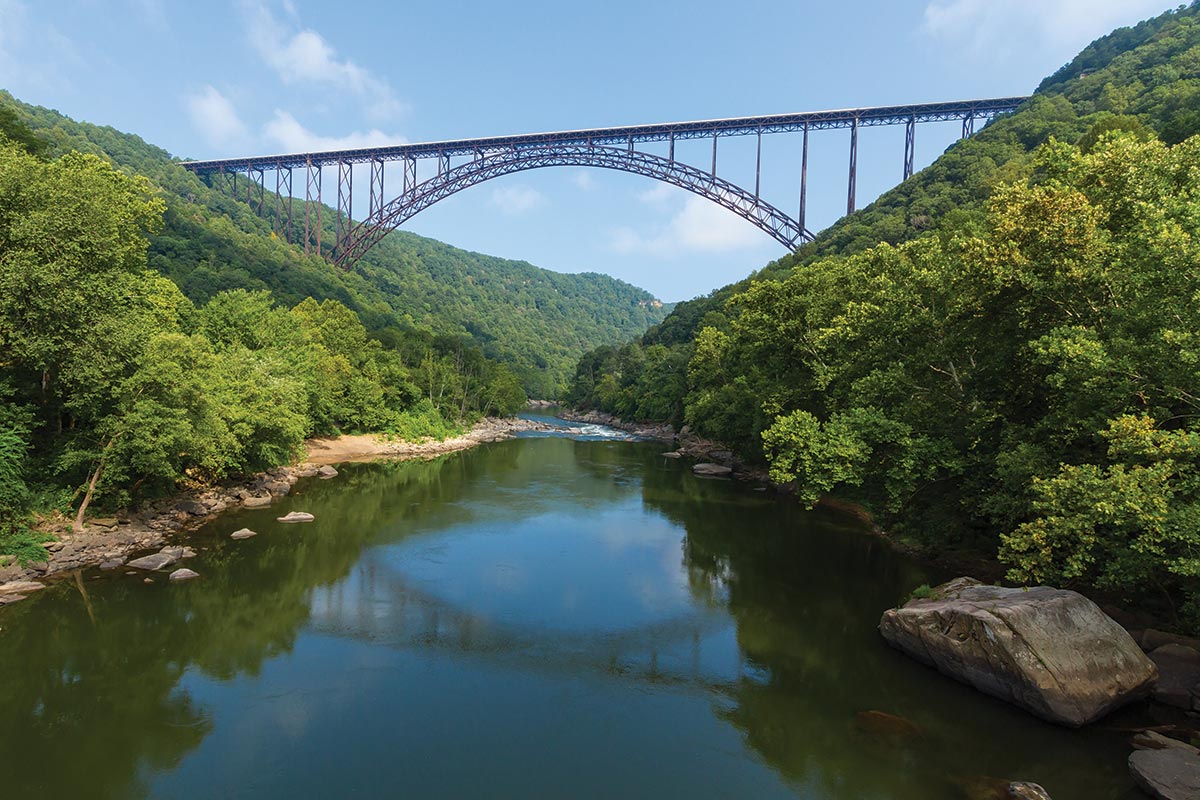
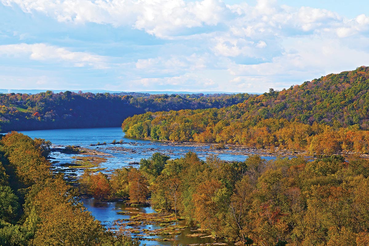
New River
The New River is one of the oldest rivers on earth, and with its many major tributaries, encompasses more than 70,000 acres of land starting from Bluestone Dam to Hawk’s Nest Lake. The total length is approximately 360 miles cutting through North Carolina, Virginia and West Virginia before joining the Gauley River.
The most famous section is called the New River Gorge—a national park in West Virginia where the New River cuts a deep canyon within the Appalachian Mountain range. As the New River crisscrosses through the George Washington National Forest, it creates a wide range of diverse ecosystems and habitats for rare birds, mammals and amphibians. The river itself contains a collection of unique aquatic environments that support native fish, mussels and crayfish.
Besides its environmental importance, the New River is fantastically scenic, beloved by fishermen, kayakers, hunters and rafters. The Lower Gorge portion has Class III to V rapids, attracting whitewater enthusiasts from around the world (when the dam is released, April to October). The Upper Gorge has gentler whitewater for those seeking less challenging, year-round rafting.
There are multiple towns along the New River to visit, including Pearisburg and Narrows, both in Giles County, Virginia. Other famous entry points are around the Gauley Bridge in Fayetteville and Thurmond, West Virginia, located in the Greenbrier Valley. Outfitters in these towns can set up tubing, rafting, fishing and scenic touring expeditions for visitors. Driving distance to Narrows is a little over four hours.
James River
Virginia’s scenic and historic James River begins in the Allegheny Highlands, near Bath County, and flows west 348 miles to the Chesapeake Bay. A third of all Virginians live within its watershed—it covers 10,000 square miles. The river’s health has improved in recent decades thanks to advocacy efforts of citizens and organizations like the James River Association.
Today, opportunities for outdoor recreation are abundant along the James. Outfitters including Twin River Outfitters, James River Adventures, James River Reeling & Rafting and Riverside Outfitters provide services that connect people to experiences on the river. The Upper James River Water Trail consists of 59 miles of the 64-mile Blueway. Natural Bridge State Park, Virginia’s newest state park, features a well-known natural wonder created by Cedar Creek, a tributary of James. The Appalachian National Scenic Trail crosses the James River via a pedestrian bridge at Snowden. Richmond’s Falls of the James, where Virginia’s rolling piedmont meets the coastal plain, features rapids for whitewater rafting and kayaking. Richmond’s James River Park System is the most-visited attraction in the Richmond region and accommodates a variety of outdoor recreation activities, including canoeing, kayaking and paddleboarding. The Captain John Smith Chesapeake National Historic Trail along the James recognizes Captain Smith’s explorations of the James River and Chesapeake Bay from 1607 through 1609, telling the story of American Indians and their river-focused cultures. Drive time to Richmond is two hours.
Nottoway River/Chowan River
Located in a remote section of Southeast Virginia, the Nottoway River begins in Nottaway County, then makes its way through Southampton County. The river continues to the border of North Carolina where it joins the Blackwater River. At this point the rivers join to form the Chowan River, which continues south as it flows into the Albemarle Sound.
The Nottoway River is a favorite of fishermen who love catching the native largemouth bass and popular with paddlers who relish exploring the Cypress Bridge Swamp Natural Area Preserve. This Preserve has some of the biggest trees in Virginia, believed to be more than 1,000 years old.
Key places to access the river are the Shady Brook Trail Boat Ramp (Hercules) and Nottoway Falls Reservoir. To see natural falls consisting of beautiful rock structures, visit Victoria, Virginia. Paddlers can gear up at the confluence of the Nottoway and Blackwater River basin for fishing and paddling. Distance from Fairfax County to the Blackwater Preserve is 3.5 hours.
Chickahominy River
Only 87 miles long as it dumps into the much larger and longer James River, the Chickahominy River is nonetheless a river of importance. Located in the east central portion of Virginia, the headwaters flow through seven jurisdictions northwest of Richmond. The Chickahominy is also part of the Chesapeake Bay Watershed.
The river was mentioned in Captain John Smith’s 1607 writings about his first voyage west when he was captured by the Chickahominy Indians and taken to meet Chief Powhatan, father of Pocahontas. Smith took many trading trips down the Chickahominy to barter for supplies of corn to feed the colonists. Later in history, two important Civil War battles were fought on its shores.
Today, several rowing clubs take longboats out on the Chickahominy. Visitors come to canoe or kayak around the fertile wetland islands, including Wright, Old Neck, Parson and Yarmouth, where the Chickahominy is home to a wide array of seabirds, fish and crab. Paddlers follow the Chickahominy Water Trail as it meanders through freshwater tidal marshes and bald cypress swamps. The trail begins near Walker’s Dam and ends when it joins the James River after Gordon Island at Chickahominy Riverfront Park.
Those seeking overnight accommodations should look around Charles City, the birthplace of America’s ninth president, William Henry Harrison. Another option is to stay in Richmond or Hampton Roads. Drive time is about 2.5 hours.
Shenandoah River
The legendary Shenandoah River has often inspired poetry and songs heralding its mystical beauty. This once pristine 55-mile river begins in Rockingham County, Virginia, and meanders through mountain and field to the eastern panhandle of West Virginia. Over the centuries, erosion has altered its path, and today aerial views show that the Shenandoah River has a unique, recurring S shape as it moves toward its terminus at the mouth of the Potomac River.
Native Americans began farming the fertile land around the Shenandoah River more than 8,000 years ago. President George Washington named both the valley and river in honor of an Oneida Indian chief named Skenandoa who helped feed American forces during the Revolutionary War. By the mid-1900’s, the river was transformed into a recreational playground and was named the Canoe Capital of Virginia.
Shenandoah River Outfitters, Massanutten Adventures and Downriver Canoe Company all offer paddle, tubing and kayaking on the scenic and gentle South Fork of the Shenandoah River. Up north near Harpers Ferry, River & Trail Outfitters in Knoxville, Maryland, offers whitewater rafting, tubing and canoeing trips on the final stretches of the Shenandoah River as it tumbles into the Potomac River. They also offer paddling lessons for all levels, as well as their paddle and pickle tour, with lessons in fermenting after a 5.5-mile paddle. Driving distance to Front Royal and Harpers Ferry is about one hour.